
5 days tour from Marrakech to Merzouga
The best 5 days desert tour from Marrakech to Merzouga with camel trekking and camping at Berber camps. This trip itinerary is customizable, feel free to contact us!
Main info:
Departure location:
Marrakech
Return location:
Marrakech
Departure time:
08:00 AM
Itinerary duration
5 days/ 4 nights
Highlights of our tour:
- The Atlas mountains
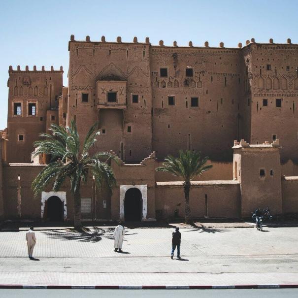
- The Kasbah of Ait Benhaddou
- Ouarzazate
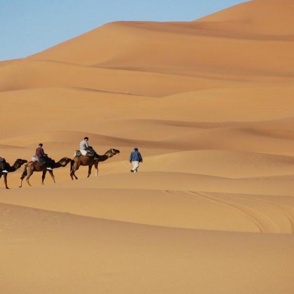
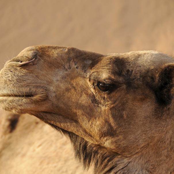
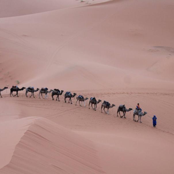
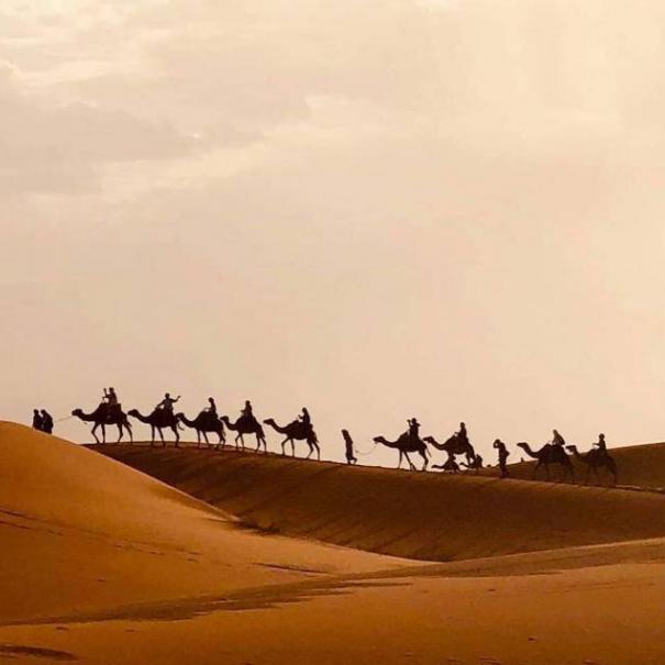
- Camel trekking
- Camping at Berber tents
- Todgha Gorges
Tour overview:
We generally begin and conclude our 5-day Marrakech desert tours package in Marrakech. It is important to note that our five-day trip gives a unique opportunity to see all the country’s most important sights in just five days. After passing through the Atlas Mountains, Ait Benhaddou, and Ouarzazate, we’ll arrive in Gorges Dades, where we’ll spend the night. As a second excursion, we’ll spend a night in the desert. With the desert excursion on the third day, you’ll get a whole different perspective on the trip. To make it up to you on the fourth day, we’ll transport you back into Ouarzazate, where you’ll spend the night there. A last trip back to Marrakech concludes the excursion.
Itinerary:
Day 1: Marrakech to Boumalne:
Day one of our Marrakech desert tours 5 day plan begins with a pick-up from your hotel in the red city. First and foremost, we will travel via the Tizi Ntichka pass (about 200 kilometers), where we will halt at a particular spot to view the cooperative argan oil. While traveling over the High Atlas Mountains, we will rest at a well-known panoramic vista that is considered the highest point of the pass (2260m). Our adventure continues as we pass over the Kasbah of Telouet on our way to Ait Benhaddou.
We’ll stop for lunch and see the fortified village of Ait Benhaddou. In general, it is regarded as one of the greatest film production locations in Africa. As a result, it is included as a Unesco World Heritage site. Many films and television shows have been filmed in this tiny town, including Gladiator, Lawrence of Arabia, and Kingdom of Heaven. Finally, we’ll travel to Boumalne Dades, specifically Dades Gorges, where we’ll spend the night and rest.
Day 2: Dades to Merzouga:
It’s time to start the second day of our Marrakech desert tour 5 days itinerary. As a first step, we will visit Todra Gorges, which is a popular climbing location. We would, however, spend some time wandering and exploring its 300m canyons. Berber Nomads bring their goats to drink from the spring if you’re lucky enough to see them. Further, if needed, we might tour carpet-making workshops. Tinghir and Tinjedad are our next stops, where we’ll eat lunch.
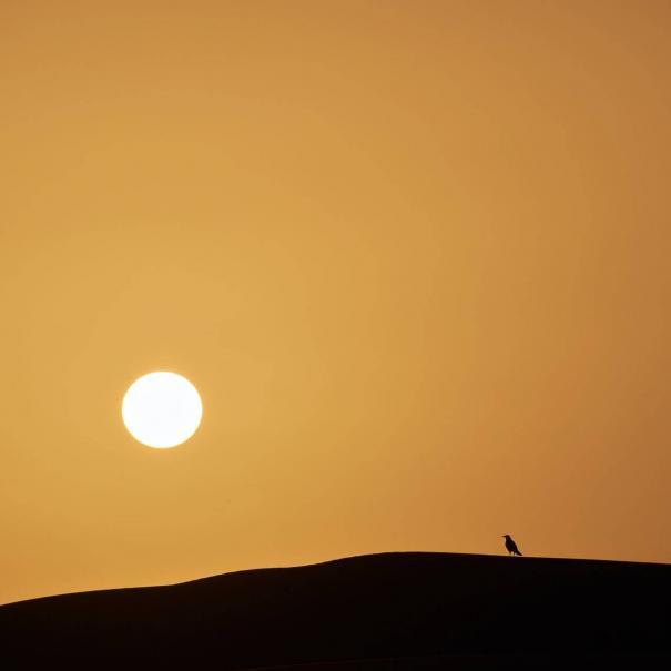
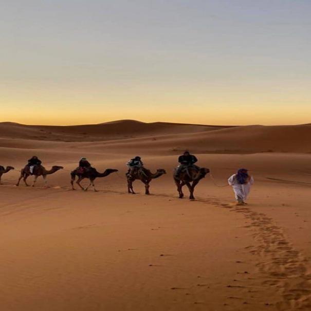
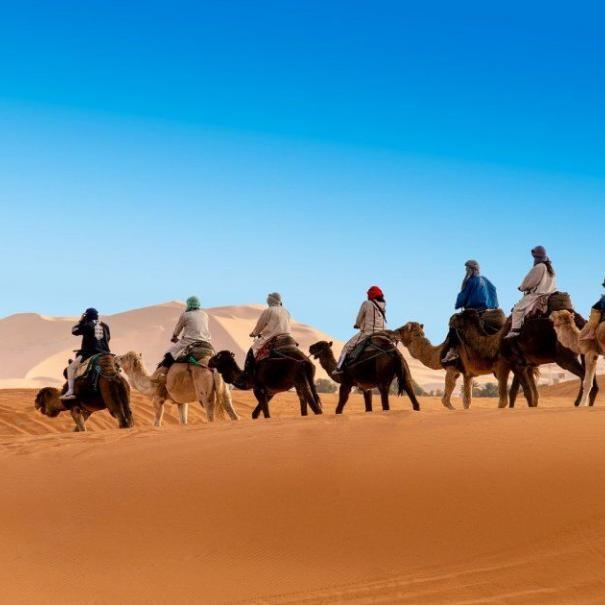
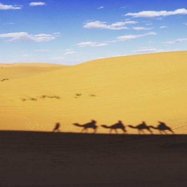
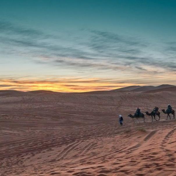
Erfoud’s fossil workshops will be our last stop before the desert. The stunning vistas of the golden dunes will undoubtedly take your breath away. We’ll ride camels across Erg Echabbi’s dunes. On the way, we’ll stop to watch the sun go down. On our way back we’ll pass through the Berber camp on our way to our final destination. First, we’ll enjoy a fantastic Moroccan dinner before all. After that, we’ll enjoy Berber music over a bonfire under the sky.
Day 3: discovery desert tour:
The third day of our 5-day Marrakech desert tour itinerary will be dedicated entirely to seeing the desert areas. The desert journey generally starts with a visit to the Berber Nomads, Morocco’s indigenous people. These folks are still living in tents with goats, sheep, and donkeys, leading a modest existence. Following that, we will pay a visit to a well-known kohl mine in the M’Ifiss region, which was once under French authority. After a time, we’ll travel to the key panoramic spots in the desert so you can take in the scenery.
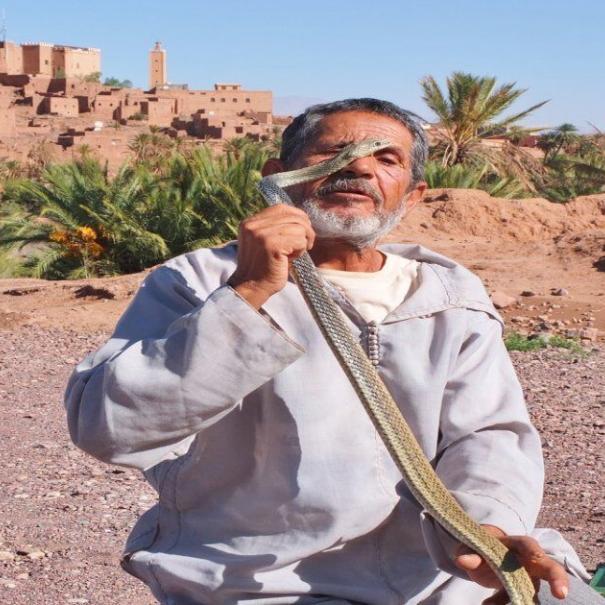
Later in the trip, we will take you to see another way of living. Gnawa people are originally from Mali and Gabon, and they settled in areas of Morocco such as Khamlia, which we will visit next. The Gnaoua are famed for their friendliness, and they will entertain you by playing music and showing you their distinctive dance moves. Finally, before dropping you off at your hotel, we will pay a visit to some of the famous Oases in the desert.
Day 4: Merzoug desert to Ouarzazate:
After breakfast at the hotel, we will continue our 5-day Marrakech desert tour itinerary. However, this time we’ll take an alternative route back to Ouarzazate. First, we’ll travel to Rissani, passing thousands of palm palms. We will stop in this city to tour one of the largest traditional Souks (Markets) in Morocco’s southeast. Following that, we will go via a number of picturesque Berber settlements.
We will arrive at Nkob at about noon and stop for lunch. Next, we will go to Daraa Valley, Morocco’s largest valley and river. We leave after touring the region and spend the night in Ouarzazate.
Day 5: Ouarzazate back to Marrakech:
The final day of our 5-day Marrakech desert tour will begin with a visit to Ouarzazate. Morocco’s Ouallywood is certainly worth a visit. As a result, we’ll have to spend the majority of our time figuring it out. Atlas Studios are without a doubt the greatest attraction in the region. Ouarzazate is well-known across the world for being an ideal location for filming and television programs. Nonetheless, shows like Game of Thrones and Prison Break were filmed in this city. Finally, when our time in Ouarzazate comes to a close, we’ll travel back through the 1000 thousand kasbahs on our way to Marrakech. Our Marrakech tour and service conclude with a drop-off at your hotel.
Tour includes:
- Pickup and drop off from accommodation.
- Camel for each in Merzouga
- Berber tent accommodation.
- Vehicle with gasoline
- Dinner and Breakfast
Tour excludes:
- Monuments fees
- Lunches
- Tips
- Soft drinks
Testimonials:
Amazing 5 days tour from Marrakech!
We arrived in Marrakech in October with my partner, from there we met Hamid and Ali from Travelling in Morocco!
From the beginning they were very kind, considerate of what we wanted. The transportation was very comfortable, we made many stops and if we wanted to take a detour or stay longer somewhere they were always ready! The first day we traveled through the atlas until we reached the desert, an amazing experience! We stopped in very comfortable hotels. We have to highlight the good vibes of the guides!
Then we arrived in Merzouga, we enjoyed there (beautiful desert) and they took us to visit the Nomads, Gnaoua and the Berbera. We are very happy with everything we met and how much fun we had! We even introduced them to our music during the trip! It should be noted that the trip is a great culture shock and one has to be open to meet and experience different situations!
Thank you Hamid, Ali and Youssef for making our trip an unforgettable experience!
Morin K
What a tour!
Excellent experience in Morocco… Hassan is fantastic to organize the tours, very attentive to our needs and super fast to respond.
Hmad was waiting for us… what can I say about him, really amazing! His responsibility to drive, the places he recommended us for meals, how much he knows about his culture and his country and the perfect way to communicate with us, we could not have had better company during our stay in Morocco.
The night in the desert, there are no words… you have to live it!!!! Very hospitable people.
INFINITE THANKS HASSAN AND HMAD FOR THIS INCOMPARABLE EXPERIENCE!!!!
I hope we can come back!
Caitriona M
Hamid is super!
These 5 days tour from Marrakech to the desert of Merzouga have been incredible. The place is magical, we have enjoyed a lot and with the help of Ali and Hamed even more. We have been lucky to enjoy their knowledge and kindness at all times. They do an excellent job with a lot of love. Highly recommended!
Anna G
Marrakech desert tour in 5 days
The best tour with the best guides Hamid and ali. Thank you for everything because it was incredible. Very attentive, polite, very polite, nice and I could go on all day … for them apart from work is a way of life and include you in it make you feel one more from minute one … put at your disposal anything you want. They move wherever you want, stop wherever you want and best of all it is a private service 100% personal. Totally recommended would be an understatement. Thanks again we will repeat without a doubt.
Martin D
Book your 5 days desert tour from Marrakech
To book your Marrakech desert tour, 5 days to Merzouga, please fill in the name of the tour in the subject field. If the itinerary we suggest is missing some of your needs please let us know, we will make sure to answer you within 24h.
Related Morocco tours:
We have customized different tour itineraries from Marrakech, desert tours, and city tours. However, if the plans below do not match what you are looking for, please fill in our contact form with your needs.
Highlights overview:
This tour of 5 days in Morocco from Marrakech to Merzouga takes you via Marrakech, Ait Benhaddou, Ouarzazate and more beautiful cities and places. In the section of the trip, we inform you about some of these places and give you some worthy information that you need to know before visiting.
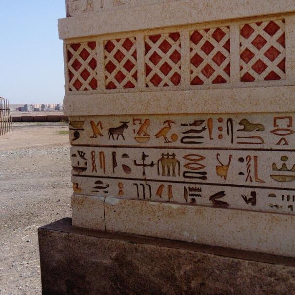
Ouarzazate & Ait Benhaddou:
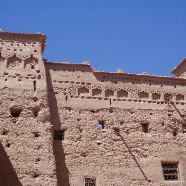
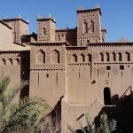
Marrakech desert tour 5 days itinerary to Merzouga is your opportunity to visit the two magnificent locations of Ouarzazate and Ait Benhaddou. The Kasbah of Ait Benhaddou, situated at the apex of the High Atlas Mountains, is the first stop. It is the first destination and is considered the primary stop station due to the spectacular vistas that it provides.
Ait Benhaddou is in the shape of a Ksar, however it is more appropriately referred to be a kasbah. For starters, the term “Ksbahs” refers to anything made of Kasab, or bamboo in English, and Ait Benhaddou is mostly composed of bamboo. During Morocco’s history, Ait Benhaddou was a trading post where traders sold their wares. Furthermore, they used to utilize it as a rest and relaxation stop before continuing their lengthy travels to Europe or Marrakech.
The El Glaoui family owns this location and was the first to discover it. They were one of the wealthiest families in Moroccan history, as they relied on taxes levied by merchants.
On the other side, there is the lovely Ouarzazate, Morocco’s Ouallywood. The Atlas Studios are what distinguishes this location and makes it worthwhile to visit. Aside from the Touarirt Kasbah labyrinth and the world’s largest solar energy facility.
In general, these two are regarded as ideal locations for filming movies and television shows. Using Game of Thrones, The Gladiator, Prison Break, and the Kingdom of Heaven as examples.
Todra and Rose valey
Toudgha canyons are perhaps the greatest place for climbers, giving about 300 meters of rugged peaks. Toudgha or Todra, located on the apex of the High Atlas mountains, gives one of the most beautiful and scenic vistas of all time. Certainly, the river that flows between the Grand Canyons adds to its beauty. There are several tiny Berber communities nearby that rely on what Toudra has to give. Most of them have little businesses in the canyons where they sell everything from leather goods to rugs. Many others have just herds of goats and sheep that drink mostly from the canyon springs.
There is, on the other hand, the Rose Valley. Because of its significance, we chose to isolate it from the other valley. This valley benefits Kalaat Mgouna, a well-known city. It provides them with many various types of roses, allowing them to create cosmetic goods and become the first in the country to do so. This city, like Erfoud, holds a yearly celebration to honor the roses. In 2015, about 500000 people attended this event, demonstrating the significance of this valley and the city of Qalaat Mgouna.
Merzouga
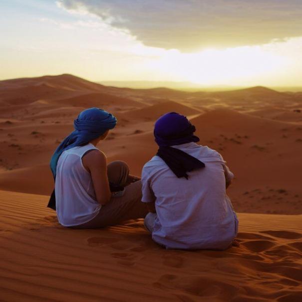
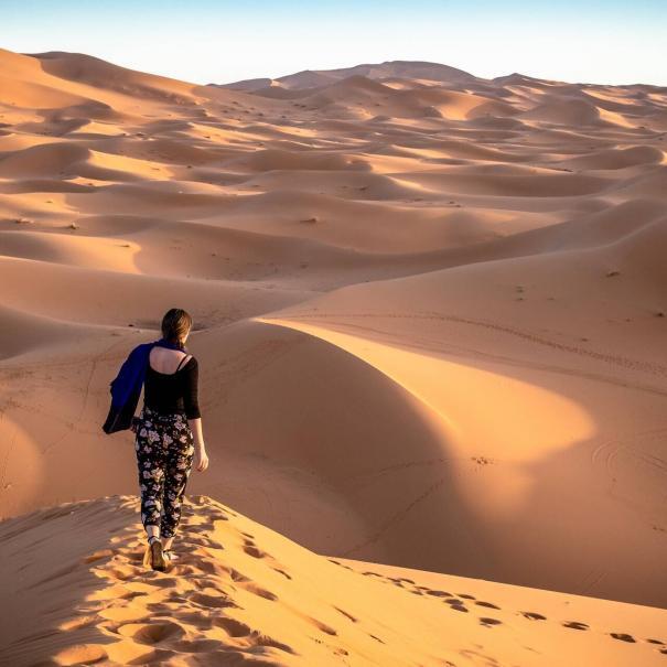
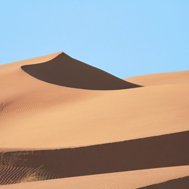
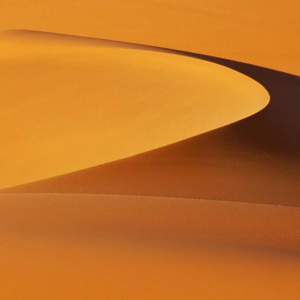
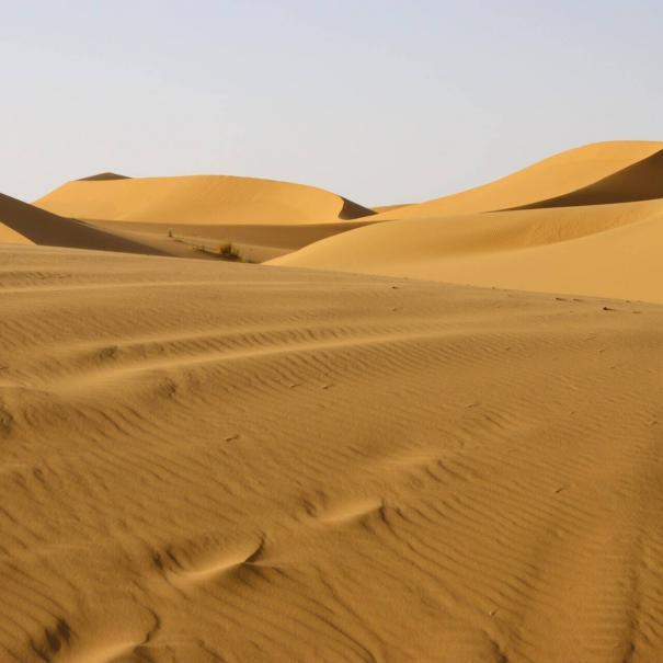
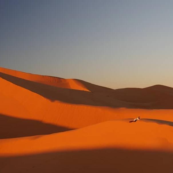
There is no question that the Merzouga desert is the greatest spot in Morocco to get a desert adventure. There are the greatest camel rides, camping (glamping), and desert tours. You may also rent a buggy or a quad and ride through the dunes.
Merzouga is located in Morocco’s farthest southeast and is just around 50 kilometers from Algeria. Merzouga is the place to go if you want to see the largest and tallest golden dunes. The highest point is said to be approximately 150 meters high, and the dunes are about 30 kilometers long. However, if you travel farther into the Southeast, you will find that other deserts may be a nice location as well.
You may have heard of Hassi Labied, Tanamoust, Khamlia, or other tiny towns that are all deemed Merzouga since wherever the Erg Chebbi desert reaches is part of this latter. However, there is a primary little city with a population of around 5000 people. The desert is a popular destination not just for visitors from other countries, but also for Moroccans seeking sand baths. Rheumatism is the most common illness among them, and hot sand is the greatest treatment.
Merzouga is well-known for its camel rides and glamping amid the dunes. However, there are additional activities available, such as the desert tour, which allows you to go on an exploration excursion to the dunes’ surrounds. You may go see the Berber Nomads, the Gnawa tribe, and many more. You may also rent a quad or a buggy and go watch the sunset or dawn.
Moroccan valleys
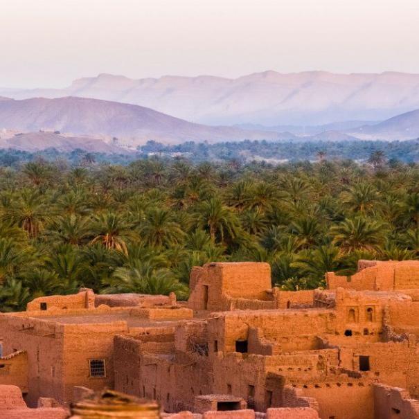
Marrakech desert tour 5 days package is an excellent opportunity to explore some of Morocco’s most beautiful valleys. These valleys were the only way for camel caravans to travel between Marrakech and the Merzouga desert prior to the building of the roadway. The first is Draa Valley, which is over 1,100 kilometers long and is the country’s largest and longest valley. Along this river are several communities with a population of around 225,000 people that rely solely on what this valley has to give. As previously stated, this valley was one of the primary routes utilized by camel caravans.
Second, you will go to the Ounila valley. On our journey to Telouet village, we pass by a river that is rather concealed. You will, however, come across it when touring Ait Benhaddou’s kasbah. It goes between the original Kasbahs and the majority of the families’ homes, close to the kasbah. Clearly, it enhances the beauty of the Ksar of Ait Benhaddou and lends a unique touch to it.
Second, there are the Dades and Toudra valleys. They are located between the cities of Boumalne Dades and Todra Gorges and provide one of the most beautiful and scenic vistas in the nation.
Above all, these valleys are vital to the people who live beside their rivers. They provide a large amount of food, such as dates and olives, in addition to magnificent vistas.
Desert cities
When you choose our 5 day Marrakech desert tour package, you will see the two main desert cities. They are where the bulk of people go to get their essentials, such as food and clothing. First and foremost, there is Erfoud. The largest city near the Erg Chebbi dunes, is located between Errachidia and the Merzouga desert.
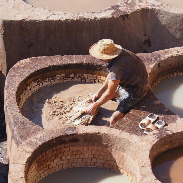
Clearly, it is one of the most significant towns in the country for date production. Every year, Erfoud receives a large number of dates from Ziz Valley, Morocco’s largest supplier of dates. And every year, Erfoud hosts a festival of well-known dates from outside the nation to commemorate this. You will find all of the different types of dates there. The finest and sweetest dates are Lmjhoul or Medjool. Erfoud is also the capital of Fossils in the Southeast. It contains a lot of tiny workshops that create various types of fossils for residents, visitors, and even export outside of the nation.
The second city is Rissani, the capital of Tafilalt. Throughout antiquity, this city served as a major stopping point for traders traveling vast distances on camels. It also has one of the largest traditional Souks in the country. People are still using conventional methods to move and sell their commodities. Donkeys are the primary mode of transportation. As a result, Rissani is well-known throughout the country for its donkey sanctuary.
Atlas mountains
The magnificent Atlas mountains are the first site on our desert journey. These well-known ranges run across three nations in a row: Morocco, Algeria, and Tunisia. The Atlas Mountains, in reality, are not a continuous chain of mountains, but are divided by enormous distances. In general, they are split into three major components in each of the three nations. First, there are the Middle Atlas Mountains, which are located in central Morocco. This later is noted for being the coldest and having more rain seasons than the others, making it a major supply of water in the country. Its tallest peak, Bou Nasser, is approximately 3,340m high.
Finally, there are the High Atlas mountains, which are the biggest and longest. They are a range that spans the preceding North African countries. They have the most magnificent landmarks and scenery since they are the longest. Furthermore, they are home to the highest summit of all the ranges, Toubkal (4,167m).
In usual, when traveling over these mountains, we use an unique pass called Tizi Ntichka, which translates as “the col of being lost.” It is the sole route connecting Marrakech to the southeast. This curving road has several stunning views to stop at, such as its highest point, which is about 2260m.